Just got a note from Emily, sounds like they're making some headway now. The weather must be cooperating enough to "git'er done" for the time being anyway.
Another dull google earth screen shot. Maybe I'll upload some trick or treating photos later on just to mix it up...
I assumed they'd be taking some time to get through what looks like a pretty heavily crevassed section, but I guess either there's good coverage, or things are just falling into place.
Friday, October 31, 2008
Thursday, October 30, 2008
Going For A Walk
I just got a note from Jasmin. The fellas have apparently been settled into the tent waiting out some weather for the past three days. They left a message saying there was a break in the weather and they were heading east through a high pass. This was Wednesday.
Judging from the low resolution image on google earth, they might get some easy travelling after the next few days. It looks relatively flat after this next section they're climbing through. At least it looks flat from here, in my armchair.
8km down, 20km to Mt Darwin.
Judging from the low resolution image on google earth, they might get some easy travelling after the next few days. It looks relatively flat after this next section they're climbing through. At least it looks flat from here, in my armchair.
8km down, 20km to Mt Darwin.
Saturday, October 25, 2008
Update!
From Jasmin:
Steve called in today. He said they had been experiencing a lot of rain and had moved approximately 4 km. They are now on a flat spot on the glacier. He and the crew think that to complete the traverse they will need a lot of good weather as the terrain is fairly complicated. Steve says there are giant spires everywhere and they are all covered in ice.
Before they got onto the glacier they ran into a french couple who have been boating around the world for a year. The couple had not seen anyone in a month and they happened across these three with their big packs. The boys got some french chocolate from them!
Camp Coordinates:
Map Number 19F
Camp 1: 422 815, 395 0868
Camp 2: 424 519, 394 9558
If you go to Google Earth you'll probably get a better look at where they are, especially in relation to where they're going.
Evidently the going has been slow and arduous; they've managed only 4km in four days. Looking at this image you can tell why: huge crevasses!!! Navigating that terrain, in the rain, with giant packs and sleds can't be so much fun.
Hopefully things clear up and they slay bluebird pow all the way to Bahia Yendegaia.
Steve called in today. He said they had been experiencing a lot of rain and had moved approximately 4 km. They are now on a flat spot on the glacier. He and the crew think that to complete the traverse they will need a lot of good weather as the terrain is fairly complicated. Steve says there are giant spires everywhere and they are all covered in ice.
Before they got onto the glacier they ran into a french couple who have been boating around the world for a year. The couple had not seen anyone in a month and they happened across these three with their big packs. The boys got some french chocolate from them!
Camp Coordinates:
Map Number 19F
Camp 1: 422 815, 395 0868
Camp 2: 424 519, 394 9558
Camp 3 (700m): 424 726, 394 7349 (this is their present location)
If you go to Google Earth you'll probably get a better look at where they are, especially in relation to where they're going.
Evidently the going has been slow and arduous; they've managed only 4km in four days. Looking at this image you can tell why: huge crevasses!!! Navigating that terrain, in the rain, with giant packs and sleds can't be so much fun.
Hopefully things clear up and they slay bluebird pow all the way to Bahia Yendegaia.
Thursday, October 23, 2008
Who's envious now?
Well, no news from the boys, but Steve sent me this picture to post at some future date to keep everyone engaged. I assume it was a kind of "hey look at us smiling away, ready to have some fun, while you suckers are at home, working like slaves, envious of our travels."
I'm not envious. Okay, maybe a little.
But let's think about where they may be right now, 8:46pm on a Thursday night. Probably lying in the tent, starting to smell a little, just finished a delicious meal of gruel with a generous topping of salt. Filling their sleeping bags and tent with the 'off gas' from TVP...
Hmmm, maybe I'll go upstairs, put some clean socks on, sit down for a phat steak and put some more wood on the fire. Then maybe I'll climb into a nice, warm, comfortable bed.
I'm not sure how envious I am of them after all...
Bring it!
Tuesday, October 21, 2008
Thank You PA
After some last minute beurocracy that nearly shut us down, we´re finally out the door and in the zodiac to Seno Agostini for the start of this traverse! We´d like to thank the kind people of Punta Arenas who went way out of their way to help us.
Most important, we´d like to thank the folks at Hostal Hain, especially Lily, whose network of contacts in Chile basically organized our trip. From getting maps to pushing through 20 days worth of government paperwork in 3 hours, her endless enthusiasm and good nature got the impossible done. She is a gem and none of us would be the least bit surprised if she´s runing this country one day! And everyone else, thank you, you know who you are! We´re out the door to a world of ice and snow (and wind....)
Monday, October 20, 2008
Latest photos
Here are some shots we got from a local friend Stjepan Pavicic, who runs the Patagonia Expedition Race every year down here. Hot off the press.
The Serrano Glacier (access point, then up and over the left side)
Marinelli Glacier area, showing the main cordillera in the distance
Peaks at the entrance of Fiordo D'Agostini
Some traverse friendly terrain. Why we don't want to go to the south side.
Garibaldi Glacier area, on the south side
Time to shred- Monte Darwin, probably
Sunday, October 19, 2008
Modismos del Viaje - Trip Dictionary - Part 1 PreTrip
Here is a quick glossary of terms that have evolved in preparation for the Darwin Range Traverse.
let´s do this - what "i have a dream.." is to Martin Luther King Jr, what "one giant leap for mankind" is to NASA, what "i´m lovin´it" is to MacDonalds, is what "let´s do this" is to the team of the Darwin Range Traverse.
bencina blanca - also known as gasolina blanca. A highly noxious substance and known carcinogen used in Patagonia for stripping paint from cars, eliminating gang style grafitti, and easily removing that irritating rust at the edge of the toilet bowl. And oh yeah...used in camping stoves to cook food too.
BOOM - an explosive term, used mostly by team member Steve Ogle, to inflate the importance of an otherwise banal story or point. eg."I was walking down the sidewalk looking for an internet cafe and minding my own business and then, BOOM, my shoelace came undone."
polishing a turd - a term only used by team member Kari Medig during times of creative depression that refers to the seemingly insurmountable task of turning a visually unstimulating scene into a swan. Most commonly experienced when following team member Ogle on a wildlife shoot. eg. "I don't know, nothing here interests me, all I see everywhere are these penguins. Sometimes you just can't polish a turd."
make or break - a stern term, often accompanied by prolonged Clint Eastwood-esque eye contact, referring to a fundamental object or action in the planning of the expedition that is the fulcrum for the precarious balance between success and failure. eg. "See this here Gold Bond? This is MAKE OR BREAK."
penultimate - A term used, only by team member Steve Ogle, when a "big" word is needed, regardless of whether its definition or usage is correct. Often accompanied by 'vis a vis' or 'in lieu'. eg. This meal is the penultimate! Vis a vis, in lieu of the one we had last night that sucked.
Kimberley-style - when a person or thing uses fiction to make a point, as in "that guy is pure Kimberley style"; specifically, to mislead the observer by saying you are from one place when in fact you never, at any time, lived in that location (but actually lived in Cranbrook); also describes anyone sporting a full, scruffy beard and Peruvian toque.
it´s the full Ogle - refers a photograph, actually, any event that involves an act of nature or action sports scenario. Preferably, both occuring simultaneously. eg. Hey look at the ruby throated pilliated Magellan bluefooted woodpecker shredding that huge pow line, that´s the full Ogle.
it´s the full Medig - refers to Kari Medig´s style of photography, often thought to be embodying more meaning than in actuality, with an obvious disdain for corporate logos, making saleabiltiy a near impossibility. Subject matter is usually cultural in nature, often with a prominently obscured subject filling a majority of the negative space. Style shows a negligence of usual photographic ´rules´like focus and the much despised ´rule of thirds´. eg in a sentence: Look at that old guy walking down the street carrying his old skis in front of that rusty tractor, that´s the full Medig.
necessito - a predominantly gringo term derived from Castellano that is the lead to nearly every question. It is often mis-construed by native Chileans as being demanding and tactless, which it is. eg. yo necessito ayuda con todo, por que yo estoy inutil. translated: i need help with everything, because I am useless.
Saturday, October 18, 2008
Toboggan time
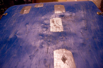
The McGiver of the trip Dean Wagner, when propositioned to build a sled for towing food and gear, went to proverbial town. There, he picked up all sorts of components: grommets, pvc, crazy carpets, webbing, duct tape. His toboggan will basically drive itself on autopilot, leaving Kari and myself in the dust with our ghetto kiddies' sleds. Check it out:
Dean in design phase. Note the chaos.
Dean's bed
Dean checking out his new skis!
A pimped out ride
Steve's sled- veteran plastic of yonderyear Patagonian trips- more character, more history, much more friction.
Dean in design phase. Note the chaos.
Dean's bed
Dean checking out his new skis!
A pimped out ride
Steve's sled- veteran plastic of yonderyear Patagonian trips- more character, more history, much more friction.
Ground beef
Start zone
The scale of the area is somewhat misleading. Originally (up until a week ago) we figured "no problem, it's only around 100km. We'll just bring extra food just in case the weather craps out.
Here are two images of sub-peaks in the area near where we’re starting our trip- at Seno d'Agostini. We think. A previous expedition of Chilenos went to this area in 2001, spending 30 days to climb three peaks along the "ridge" that separates a couple of forks in the fiord. This is our access zone- we have to blow through this area in a day or two to get to the real mountains. We have no maps that indicate elevation gains or losses at this scale- these just look like rolling hills (see aerial below).
These must have slipped between two contour lines...
You can check out a great website that some local climbers established here: http://www.cumbresaustrales.cl
We'll try to get up on one of the first icefields via the Serrano Glacier, pictured below. A lot of these images are found on Google Earth by clicking the little dots.
Here's an air photo Kari dug up of Seno D'Agostini. This was pretty much make-or-break to get this information. All that white is supposedly flat, but after a bit of research we anticipate a harsher reality.
Once we get up top it looks like we'll have to traverse terrain like this (actually we'll be on the other, north side of this), pictured in an old-school aerial...
...in a white-out
Cast of characters
Cordillera Darwin- a naturally selected ski traverse
It's 2am and I can't sleep. Nobody could with this wind, battering the walls and roof, shaking everything and everyone into a paranoid state. Except perhaps Dean, who can remain calm through anything, but I'm afraid to turn over and check. It sounds (and feels) as if a locomotive is passing over my sleeping bag and I'm lying on the tracks trying to keep a low profile, knowing that sooner or later it will pass. We're in Southern Patagonia and this is the way it goes. It's normal, they say. But if this is any indication of what the next thirty-five nights will be like, we're in for one hell of a ride.
It already feels like the elements are stacked up against us and we haven't even left the hotel yet! Kari and Dean are out checking on the white gas we bought yesterday, which seems to be more like pure benzene, I'm not sure. They were sounding pretty confused about it after setting up the stoves. It might also be lack of sleep- with the wind it was another restless night and today we face another full day of sorting gear, charging batteries, practicing crevasse rescue, and of course larding up on all-you-can-eat mutton at Punta Arenas' finest chinese food restaurant. Months of prep have now become minutes-- yes, the long-awaited boat departure to the start of our ski traverse happens on Tuesday morning, October 21st. This is the day we approach- and hopefully arrive at - the Cordillera Darwin, an abrupt mountain range marking the southern extremity of the Western Hemisphere. Leopard Seals, King Penguins, and all sorts of other critters frequent the surrounding waters, it's that close to Antarctica. The diversity of life up on the glaciers however will be much lower, consisting primarily of three ski tourers from Canada and a few condors waiting for an outcome. Few people have ever passed through this range and to our knowledge, none have made a lengthwise traverse of the mountains. I say "to our knowledge" because there is basically zero information on this area. Few maps exist- in fact none are better than low-res Google Earth that you're looking at here. For the last week we've tried for a fixed-wing overflight of the range but the weather has shut us down. And we slept in once or twice.
Check out the following maps. The first is an overview of South America, showing the general location of the expedition. The second is a closer inspection offering our start and end points and where we are presently located, in Punta Arenas. We hope to get picked up by a boat at the southeast end of the range after arriving at a Chilean Navy depot. The third map shows a detail of our proposed route from left to right. There are some gnarly sections as you can see, especially around Monte Darwin. Here, the distance between the highest peaks (around 2500m) and sea level is only 3km. If you go to the very south end of South America on Google Earth you can see the zone.
A sting in the tail
Yellow line divides the island of Tierra del Fuego into Chile and Argentina. Bring it!
The trail of blood from Kari's blisters
The right edge is cut-off in this one but the final point is just visible there. Our destination is Bahia Yendegaia, where lives one farmer (campesino) plus a few border guards posted in a cabin at the mouth of the bay. Depending on which side of the river we end up, we'll run into the campesino or the navy dudes.
The crew consists of myself, Kari Medig, and Dean Wagner- three friends cut from the same cloth. Three friends who will be touching the same cloth for the next month. As an afterthought to discussing how we'd set up this blog, I joked with Kari this morning that it could be a good legacy to leave, if for whatever reason we didn't make it back.
"Don't say that! I don't want my mom reading that," Kari responded. "It's true though," he adds, looking away...
Okay, have I built up enough drama? Good, because it seems to be the only means of drawing the attention of readers these days. With the help of Ryan Gill, our blogmaster extraordinaire (basically the only ski buddy we have back home with the expertise), these postings will be available for you to check out over the next month or so. Unfortunately this entry will pretty much be the only detailed account, since we had some technical difficulties with our original plan to email words and photos from en route to Outside Magazine with some high-tech gizmos. Now we're down to one sat phone and one battery so all you'll be getting is a UTM coordinate update every five days or so. Hopefully Ryan has a chance to update the blog so friends and family can keep track of us. Yeah, it's pretty simple and less dramatic but that's reality- believe it or not. If we make it more than five of the 120 kilometres, we'll be happy.
In the meantime you can check out our info package we sent to sponsors below. It's basically a too-much-information pdf that outlined the trip objective, motivations and information about ourselves. With this simple media kit (with Kari's sleek design) we were able to lure in the following companies who had faith in our endeavours, knowing fully that we might not see much more than the inside of our tent:
Gore-tex Shipton-Tilman expedition grant
Patagonia
Mountain Equipment Co-op
Genuine Guide Gear
Dynafit
Allen's Griz bars
Powerbar
Centro GPS
Iridium satellite phones
Visa and Mastercard
See you at the end of the trip.
Steve, Kari, and Dean
Subscribe to:
Posts (Atom)